Snow on the Equator: Why the Rwenzori Mountains Stop Travelers in Their Tracks
Most people arrive in Uganda expecting gorillas, savanna and sunshine. Almost nobody expects to be standing in sleet at four thousand metres, roped to a stranger, with a glacier glowing blue beneath their boots and the equator just down the road. Yet that is exactly what a hike in the Rwenzori Mountains delivers.
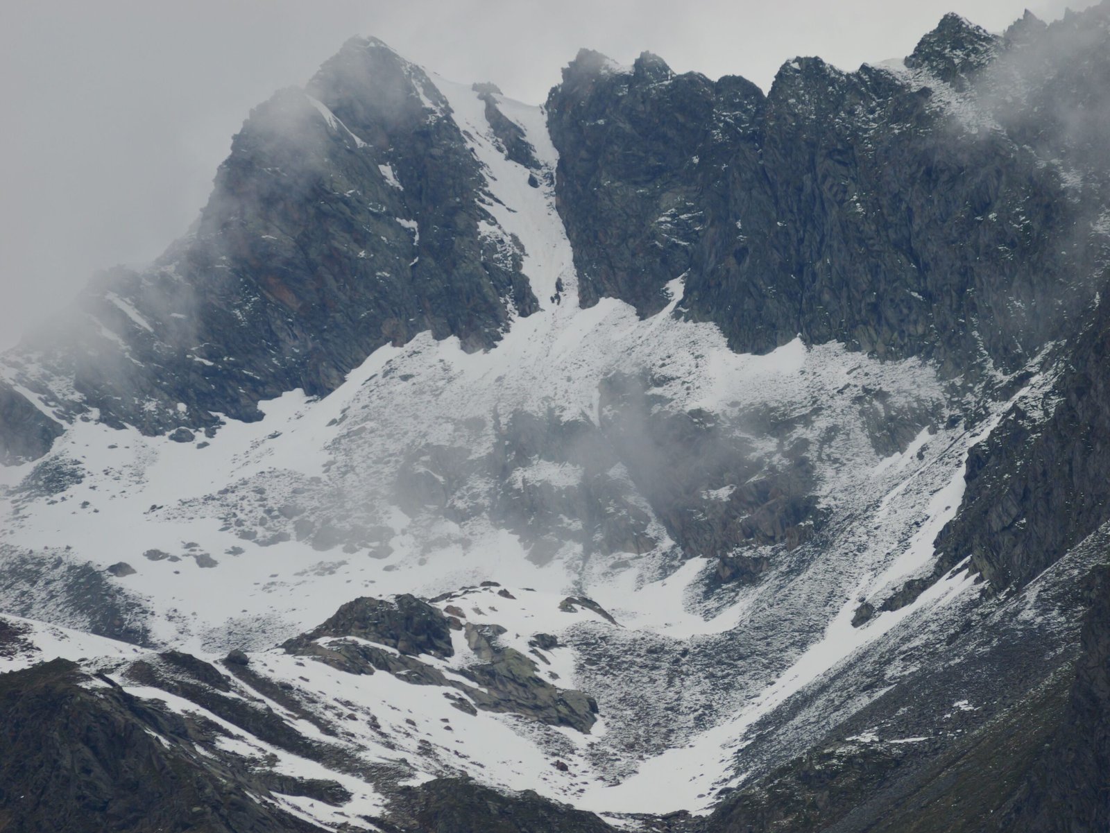
Less than half a degree north of the equator, in the far west of the country, the Rwenzori Mountains lift their ridgelines into permanent snow, and the highest of them, Margherita Peak on Mount Stanley, tops out at 5,109 meters. It is the highest point in Uganda and the third highest in Africa, behind only Kilimanjaro and Mount Kenya.
That combination, tropical latitude and glacial ice, is the whole point of the Rwenzori Mountains, and it is why serious trekkers have been drawn here for more than a century. But this is not a mountain you simply turn up and climb. The Rwenzori Mountains are wet, muddy, steep and remote, and the upper reaches demand real mountaineering skill.
This guide explains how to hike the Rwenzori Mountains properly: what makes the range different, which route suits which traveler, what each day on the trail looks like, how to deal with altitude and weather, and what to pack. By the end you should know whether the summit is realistic for you, or whether a shorter trek into the lower valleys is the smarter and more enjoyable choice.
What Makes the Rwenzori Mountains Different from Kilimanjaro and Mount Kenya
If you have climbed Kilimanjaro or Mount Kenya, forget most of what you think you know. Those mountains are volcanoes, single great cones rising from the plains. The Rwenzori Mountains are something else entirely, a block of ancient rock thrust upward by the same tectonic forces that tore open the Albertine Rift, which is why the range is a long, jagged chain of peaks rather than one tidy summit. Mount Stanley, Mount Speke, Mount Baker, Mount Emin, Mount Gessi and Mount Luigi di Savoia each carry their own glaciers and their own personality.
The Rwenzori Mountains are also known as the Mountains of the Moon, a name traced back to the ancient Greek geographer Ptolemy, who described snow-fed mountains feeding the Nile. Whether or not he truly meant the Rwenzori Mountains, the name stuck, and it suits them. The Rwenzori Mountains National Park covers roughly 996 square kilometres and is a UNESCO World Heritage Site, protected for both its scenery and its extraordinary plant life.
What really separates the Rwenzori Mountains from East Africa’s other big peaks is the character of the hike. Kilimanjaro is a long, steady walk. The Rwenzori Mountains are a scramble through bamboo, over bogs and across rock slabs, in cloud and rain more often than not. Above the snowline, reaching Margherita Peak is a genuine technical climb that needs ropes, crampons and ice axes.
Many experienced mountaineers rate the Rwenzori Mountains as one of the hardest and most rewarding high-altitude objectives on the continent, precisely because it combines remoteness, weather and glacier travel in one trip.
The Glaciers: A Race Against Time
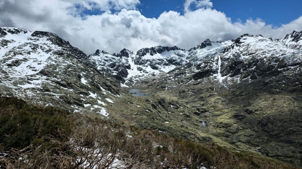
There is an urgency to hiking in the Rwenzori Mountains that has nothing to do with the schedule. The glaciers in the Rwenzori Mountains are shrinking. When the Duke of the Abruzzi led his famous expedition in 1906, the photographer Vittorio Sella recorded broad ice fields across the upper peaks, and even then his images suggested the glaciers had begun retreating.
Over the century since, the ice in the Rwenzori Mountains has contracted dramatically, and researchers who monitor the range have warned that the remaining glaciers could vanish within the coming decades if current trends continue.
For a traveler, this adds weight to the experience. Standing on the Stanley Plateau and looking at ice on the equator is not something future visitors may be able to do. Some peaks that once held glaciers now show bare rock, and routes that required glacier travel a generation ago have changed shape. This is one reason local guides and operators encourage people not to postpone a Rwenzori Mountains trek indefinitely. The Rwenzori Mountains will always be beautiful, but the snow is the rare part.
Choosing Your Rwenzori Mountains Hike: Trek or Summit
Before booking anything, decide honestly what you want from the Rwenzori Mountains, because the Rwenzori Mountains support very different trips. The first is a trek without the summit. Many visitors follow the Central Circuit, the classic loop through the heart of the range, which climbs through forest, bamboo and heath into the high alpine zone, passes glacial lakes and crosses a high pass before dropping back down.
Done at an unhurried pace it takes around six or seven days, and it needs good fitness and the right clothing, but not technical climbing skills. A shorter and very popular version heads up toward Weismann’s Peak at 4,620 metres on Mount Speke, usually in about five days, which gives you the full atmosphere of the Rwenzori Mountains without ropes.
The second option is the summit of Margherita Peak. This adds the glacier crossing and the final rock climb to the circuit, stretching the trip to somewhere between seven and twelve days depending on the route, the weather and your pace. Here you need real mountain experience, or at the very least the willingness to learn basic glacier skills with your guides. There is no shame in choosing the first option. Some of the most memorable parts of the Rwenzori Mountains, the giant plant life, the glacial lakes, the hut evenings above the clouds, happen well below the snow.
There is also the Kilembe route, which approaches the Rwenzori Mountains from a different valley and offers an alternative for trekkers who want a quieter, less trodden experience than the main Central Circuit. Operators can advise on which approach suits the season and the group.
The Central Circuit Day by Day
A typical Rwenzori Mountains hike on the Central Circuit begins at the trailhead community of Nyakalengija, a short drive from Kasese. Altitudes below are approximate and vary slightly between sources, but they give a feel for the rhythm of the trek.
The first day follows the Mubuku River valley up through dense, moss-draped montane forest to Nyabitaba Hut, at about 2,650 metres. It is a warm-up, steep in places, with birds calling overhead and the first signs of just how wet the Rwenzori Mountains can be. The second day is longer and tougher. You cross streams on log bridges, climb through bamboo and then heath, and arrive at John Matte Hut at roughly 3,500 metres. This is where the vegetation starts to look like something from another planet.
The third day crosses the famous Bigo Bog, a long stretch of boardwalk, mud and tussock that gives the Rwenzori Mountains much of their reputation, before climbing to Bujuku Hut at nearly 4,000 metres, set beside Lake Bujuku beneath the glacier-draped faces of Mount Stanley and Mount Speke. For hikers aiming at Margherita Peak, the route continues up to Elena Hut at about 4,540 metres, the high base for the summit attempt.
For the circuit trek without the summit, the route from Bujuku climbs to Scott Elliot Pass, roughly 4,400 metres, the high point of the loop, then drops past the Kitandara Lakes at about 4,000 metres. From there the trail descends through Guy Yeoman Hut and back down to Nyabitaba, completing the circle through some of the most spectacular alpine scenery in East Africa.
Summit Day on Margherita Peak
Summit day in the Rwenzori Mountains starts in the dark. From Elena Hut, climbers rope up, strap on crampons and head out across the glacier by headlamp, because the best conditions are early in the morning before the cloud builds and the surface softens. The route crosses snow and ice onto the Stanley Plateau, then finishes with a rock scramble to the top of Margherita Peak. Guides lead and manage the ropes, and the exact path changes as the glaciers change, which is why local knowledge matters so much.
It is a long, demanding day, typically eight to twelve hours there and back, and the weather decides everything. On a clear morning the views are staggering, with the whole spine of the Rwenzori Mountains laid out beneath you and the rift valley falling away in the distance. On a bad day, the cloud closes in and a good guide will turn the group around without hesitation. Summit success in the Rwenzori Mountains is never guaranteed, and the climbers who enjoy it most are the ones who treat reaching the top as a bonus rather than a promise.
Weather, Mud, and the Best Time to Hike the Rwenzori Mountains
Be prepared for one fact above all others: the Rwenzori Mountains are wet. They catch moist air rolling in from the west and across the Albertine Rift, and rain, mist and mud are normal in the Rwenzori Mountains at any time of year. Even so, the best windows for a Rwenzori Mountains hike are the drier months of June to August and December to February. During these periods trails are firmer, the cloud lifts more often, and summit attempts have the best chance of clear conditions. If your goal is Margherita Peak, June to August is generally considered the strongest climbing window.
The wetter months, March to May and October to November, are not impossible, but the trails turn into rivers of mud, rivers swell, and visibility drops. Anyone trekking in the Rwenzori Mountains then should expect a harder, slower trip. Whatever the season, plan for the bogs. Waterproof gaiters and sturdy boots are not optional extras in the Rwenzori Mountains, and many trekkers hire rubber boots at the trailhead precisely because they cope with the mud better than leather hiking boots do.
Fitness, Altitude, and Acclimatization
Hiking in the Rwenzori Mountains is physically demanding, and it deserves an honest conversation about preparation. The Rwenzori Mountains route climbs from around 1,600 metres at the trailhead to well over 4,000 metres in just a few days, which is fast by mountaineering standards. Altitude sickness is a real risk, and it does not care how fit you are. Headaches, nausea, poor sleep and loss of appetite are common signs, and they should be taken seriously.
The best protection is sensible pacing. Walk slowly, drink plenty of water, eat even when you do not feel like it, and tell your guides immediately if you feel unwell. Many trekkers talk to their doctor before the trip about whether altitude medication is appropriate for them, and that decision belongs between you and a medical professional. If symptoms get worse, the only reliable treatment is to descend, and good guides will insist on it.
Start training at least two or three months ahead. Long hikes with a loaded pack, stair climbing and regular cardio work all help. If you are targeting Margherita Peak, a basic glacier skills course beforehand is worth considering, and travel insurance that covers trekking to 5,000 metres and emergency evacuation is essential for anyone planning a Rwenzori Mountains hike.
What to Pack for a Rwenzori Mountains Trek
Packing for the Rwenzori Mountains means preparing for rain, cold and mud in the same afternoon. A genuinely waterproof jacket and trousers matter more than almost anything else. Layers work better than a single heavy coat, so bring thermal base layers, a fleece or insulated mid-layer, a warm hat, gloves and spare socks, because dry socks at the end of the day are worth their weight in gold. Waterproof gaiters protect against bog water, and trekking poles take a surprising amount of strain off tired knees on the steep sections.
At altitude in the Rwenzori Mountains the huts get cold at night, so a good sleeping bag rated for freezing temperatures is important, along with a headlamp with spare batteries, a dry bag or heavy-duty liner for your pack, sunscreen and sunglasses, since glare off snow and thin air is brutal on skin and eyes.
Bring water purification tablets or a filter, high-energy snacks and a small first-aid kit. For Margherita Peak, you will need a climbing harness, helmet, crampons, ice axe and rope. Most operators can hire these out, but confirm what is included well before you travel, and pack your main kit in a soft duffel bag that porters can carry easily.
Guides, Porters, Huts, and Permits
You cannot hike the Rwenzori Mountains alone. Guides are compulsory, and porters are strongly recommended, both for safety and because they provide jobs that sustain the communities around the park. The Uganda Wildlife Authority manages Rwenzori Mountains National Park, and community-run trekking operators at the trailheads organize guides, porters, cooks and hut bookings for most visitors.
Park fees, hut fees and guide and porter charges are set by the authority and the operators and change from time to time, so always confirm current rates when you book rather than relying on an old figure.
The huts along the Rwenzori Mountains trail are simple but welcome after a hard day, with bunk beds, a communal area and a cook preparing hot meals. They are not luxurious, but sitting in a hut at 3,500 metres with a mug of tea while rain hammers the roof is part of the Rwenzori Mountains experience. Book early for the dry season, because space on the trail is limited and the best weeks fill up quickly.
The Plants and Wildlife of the Rwenzori Mountains
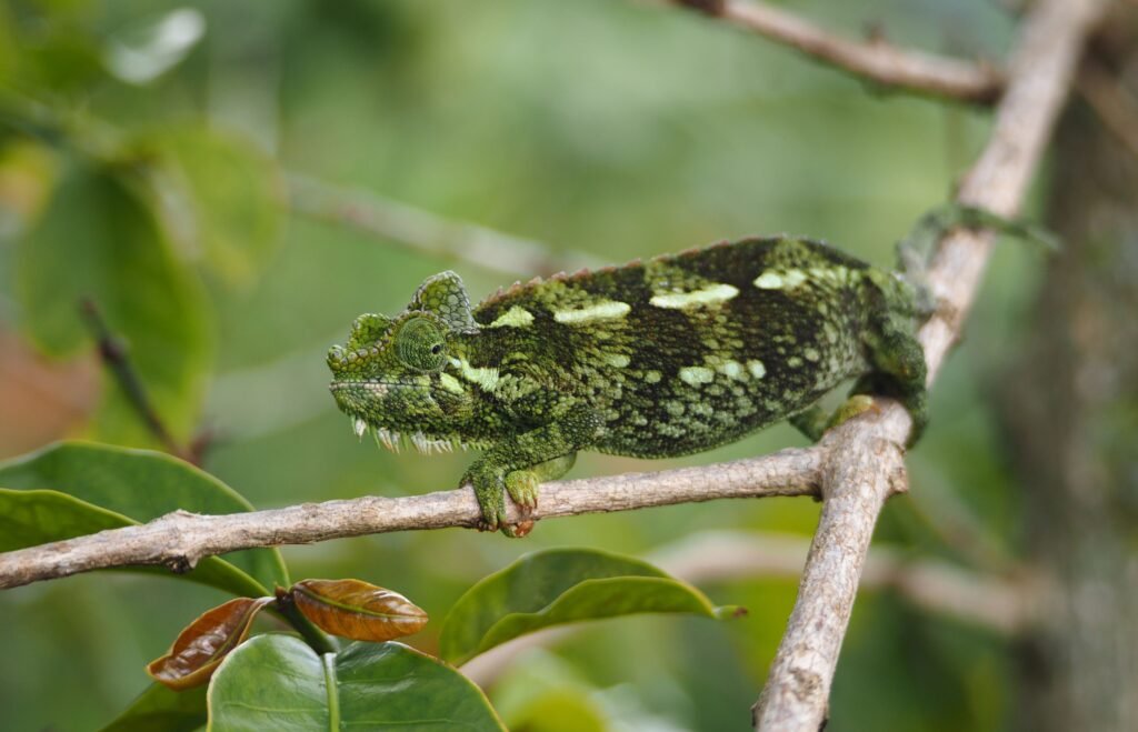
Even if you never reach the snow, the Rwenzori Mountains reward anyone who walks them with some of the strangest and most beautiful vegetation on earth. As you climb, the forest gives way to bamboo, then to heath draped with moss and lichen, and finally to the afro-alpine zone, where giant lobelias and towering groundsels stand like prehistoric sculptures. The oversized plants are a result of the cold nights and intense sun at altitude, and they make the Rwenzori Mountains a dream for photographers.
Birdlife is rich too, with well over two hundred species recorded across the Rwenzori Mountains, including the Rwenzori turaco, a stunning bird found only in this part of Africa. Look for the Rwenzori three-horned chameleon in the lower forest, along with monkeys in the trees and sunbirds feeding on the high-altitude flowers. Wildlife is not the main reason to hike the Rwenzori Mountains, but it adds a layer of delight to every day on the trail.
Trekking the Rwenzori Mountains Responsibly
A mountain this fragile deserves careful visitors. The Rwenzori Mountains hold some of the most delicate alpine ecosystems in Africa, and the trails, bogs and glacial lakes recover slowly from damage. Stay on marked paths, carry out every piece of rubbish, and keep soap and detergents away from streams and lakes. Hiring local guides and porters, buying food and supplies in the foothill communities and choosing locally run lodges all help ensure that tourism benefits the people who live closest to the Rwenzori Mountains.
Responsible trekking protects the plants, the water and the ice for the next traveler, and it makes your own Rwenzori Mountains hike feel more meaningful too.
Getting There and Planning Around the Rwenzori Mountains
The gateway to the Rwenzori Mountains is Kasese, a town in western Uganda roughly six to seven hours by road from Kampala, or about an hour and a half from Fort Portal. The Rwenzori Mountains trailhead is a short drive beyond town, and most trekkers spend a night in a lodge near the foothills before and after the hike to rest and sort their gear. Charter flights can shorten the journey for travelers short on time.
The Rwenzori Mountains fit neatly into a wider western Uganda itinerary. Combine the trek with a game drive and Kazinga Channel boat cruise in Queen Elizabeth National Park, a chimpanzee trek in Kibale Forest or Kyambura Gorge, and a day exploring the Fort Portal crater lakes. Many travelers also pause at the equator marker near Kasese to take the obligatory photo, which feels especially fitting after a week in the Rwenzori Mountains. After days of mud and cold, a hot shower and a long lie-in at a lodge near Kasese feel like the greatest luxuries on earth.
Frequently Asked Questions About Hiking the Rwenzori Mountains
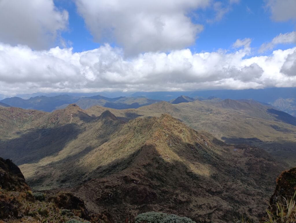
Is there really snow in the Rwenzori Mountains? Yes. The highest peaks, including Mount Stanley, Mount Speke and Mount Baker, carry snow and glaciers, even though they sit almost on the equator. The ice is shrinking, but you can still reach it on a high-altitude Rwenzori Mountains trek.
Do I need climbing experience to hike the Rwenzori Mountains? Not for the circuit trek or the shorter routes toward Weismann’s Peak. For Margherita Peak you need to be comfortable on ropes, in crampons and on exposed rock, or be prepared to learn the basics with your guides before the summit day.
How long does a Rwenzori Mountains trek take? Shorter treks take around five days, the full Central Circuit six or seven, and a Margherita Peak attempt between seven and twelve days depending on the route and conditions.
How cold does it get in the Rwenzori Mountains? Nights at the higher huts can drop to freezing, and the weather above 4,000 metres is cold, windy and wet. Dress in layers and expect rain at any time of year.
Is the Rwenzori Mountains hike suitable for beginners? The lower sections are accessible to reasonably fit hikers, but this is a serious mountain environment. Beginners should choose a shorter route, train well in advance and go with an experienced operator.
Plan Your Rwenzori Mountains Adventure with Tulambule
The Rwenzori Mountains are not the easiest hike in Uganda, and that is exactly why they are so memorable. Snow on the equator, giant flowers, glacier lakes and the quiet satisfaction of finishing something genuinely hard make this one of the most rewarding adventures in East Africa. Whether you want to complete the Central Circuit, test yourself on Margherita Peak, or simply spend a few days walking into the clouds, the right planning makes all the difference.